Case Study 1
Multi-Hazard Digital Twin for the Savinja Region
A reliable digital twin is only as strong as the spatial data it is built upon. High-quality and harmonised geospatial layers—such as Digital Terrain Models, building footprints, 3D building models, topographic features (water bodies, roads, and other infrastructure), and Earth Observation satellite imagery—form the foundation for meaningful simulation and decision support. While airborne campaigns provide highly detailed measurements, satellite data enables more frequent monitoring of changes in the environment and built-up areas, supporting regular updates of key digital twin layers.
From Harmonised Geospatial Backbone to Integrated Landslide–Flood Simulation
This use case demonstrates how a robust digital twin for disaster risk management must be built on a harmonised and verified geospatial backbone before advanced simulations can be meaningfully applied. Within the Digital Twin Slovenia – Precursor Applications (DTSI-P Apps), the first step was the systematic preparation and alignment of high-quality spatial datasets, including Digital Terrain Models (DTMs), orthophotos, classified LiDAR point clouds, building footprints, LoD2.2 3D building models, and selected Earth Observation imagery. Four LiDAR datasets with different resolutions and acquisition characteristics were processed, validated, and harmonised into a consistent coordinate reference system, ensuring interoperability and geometric consistency across all layers. This harmonised spatial foundation was then integrated into the DTSI-P-Core (LIFT platform), establishing a reliable baseline for simulation, visualisation, and decision support.
Building on this prepared backbone, the use case focuses on the Savinja region, where landslide susceptibility and run out were first analysed and modelled as an input layer. The predicted landslides run out were then incorporated into hydrological flood modelling to better understand compound risk scenarios, where slope instability can alter terrain morphology and consequently influence water flow paths and inundation patterns.
Four LiDAR datasets were processed, each with different resolutions and acquisition characteristics:
All datasets were verified for completeness and harmonised in terms of coordinate reference system (CRS), ensuring consistent alignment across DTMs, orthophotos, and classified point clouds.
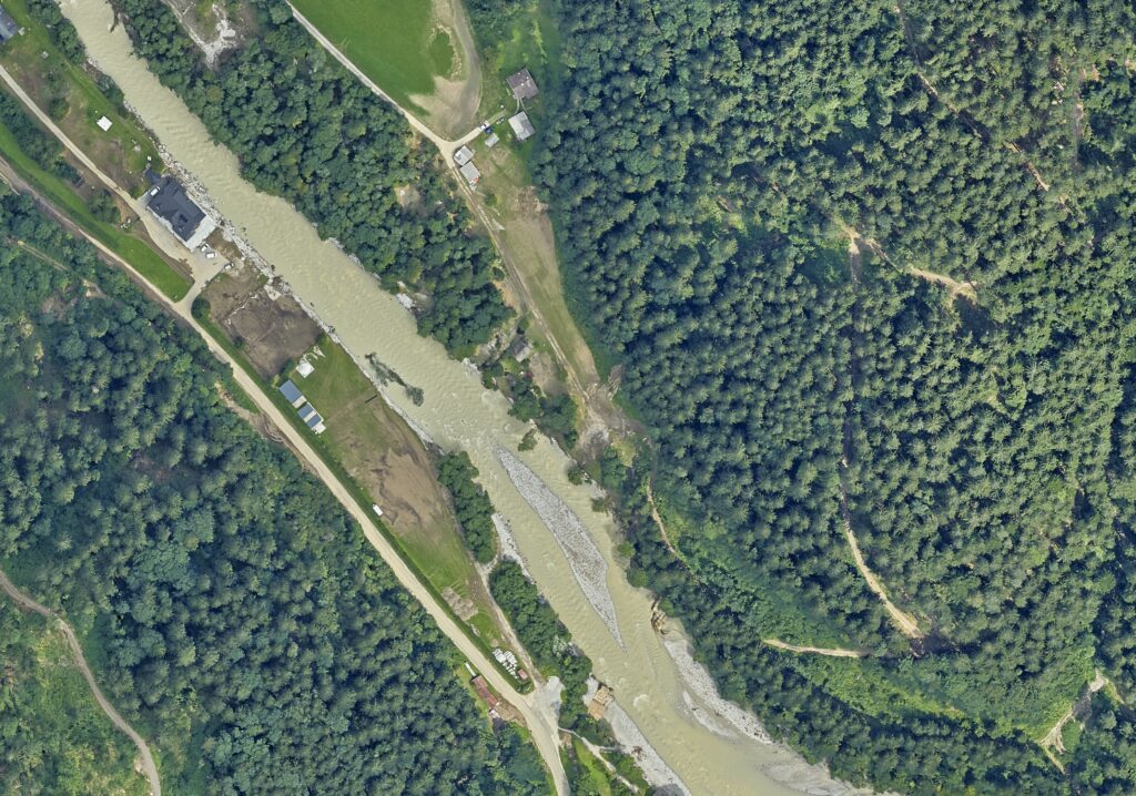
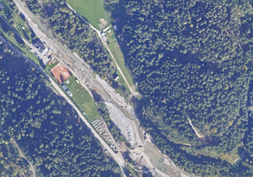
True orthophoto from August 2023 and October 2023
3D Building Models for Flood Simulation and Risk Assessment
Building on this harmonised foundation, we implemented an automated workflow for roof footprint extraction and LoD2.2 3D building reconstruction. Roof surface points were isolated from LiDAR data, roof polygons were derived and topologically corrected, and the resulting 3D building models were enriched with key geometric attributes such as ridge and eaves elevations, minimum/maximum heights, and building height.

These building models and footprints serve as a critical layer for flood-related decision support, enabling more informed assessment of risk and impact before, during, and after natural hazard events. They provide the geometric basis for property-level flood simulations, building exposure analysis, and clear 3D visualisation of affected areas—supporting civil protection authorities, government stakeholders, insurers, and spatial planners.
All harmonised spatial datasets and derived products have been successfully imported into the DTSI-P-Core environment (LIFT platform), ensuring immediate availability for further simulation, validation, and operational use.

Landslide Scenario-based Modelling with preliminary test case results
Input data layers:

Hydrological simulations were carried out for a critical downstream section (hot-spot) of the Savinja River near Solčava using the HEC-RAS hydraulic modeling software. The simulations were based on high-resolution input data to ensure realistic representation of flow conditions. As upstream boundary conditions, measured discharge data from August 2023 were used, obtained from the automated hydrological monitoring station at Solčava operated by the Slovenian Environment Agency (ARSO). These data provided a reliable basis for representing actual hydrological conditions during the study period.
Two separate simulation scenarios were developed to assess the hydraulic impact of a recent landslide event. In the first scenario, the existing (unmodified) Digital Terrain Model (DTM) was applied to represent baseline conditions of the channel and floodplain. This simulation served as a reference case, reflecting natural flow dynamics without any obstruction.
In the second scenario, the DTM was modified to incorporate the geometry and volume of landslide material deposited within the river corridor. This adjustment allowed for the simulation of altered channel conditions, specifically the partial or complete obstruction of the Savinja riverbed caused by the landslide. By comparing results from both scenarios, the analysis enabled evaluation of changes in flow patterns, water levels, and potential flood risk associated with the blockage.
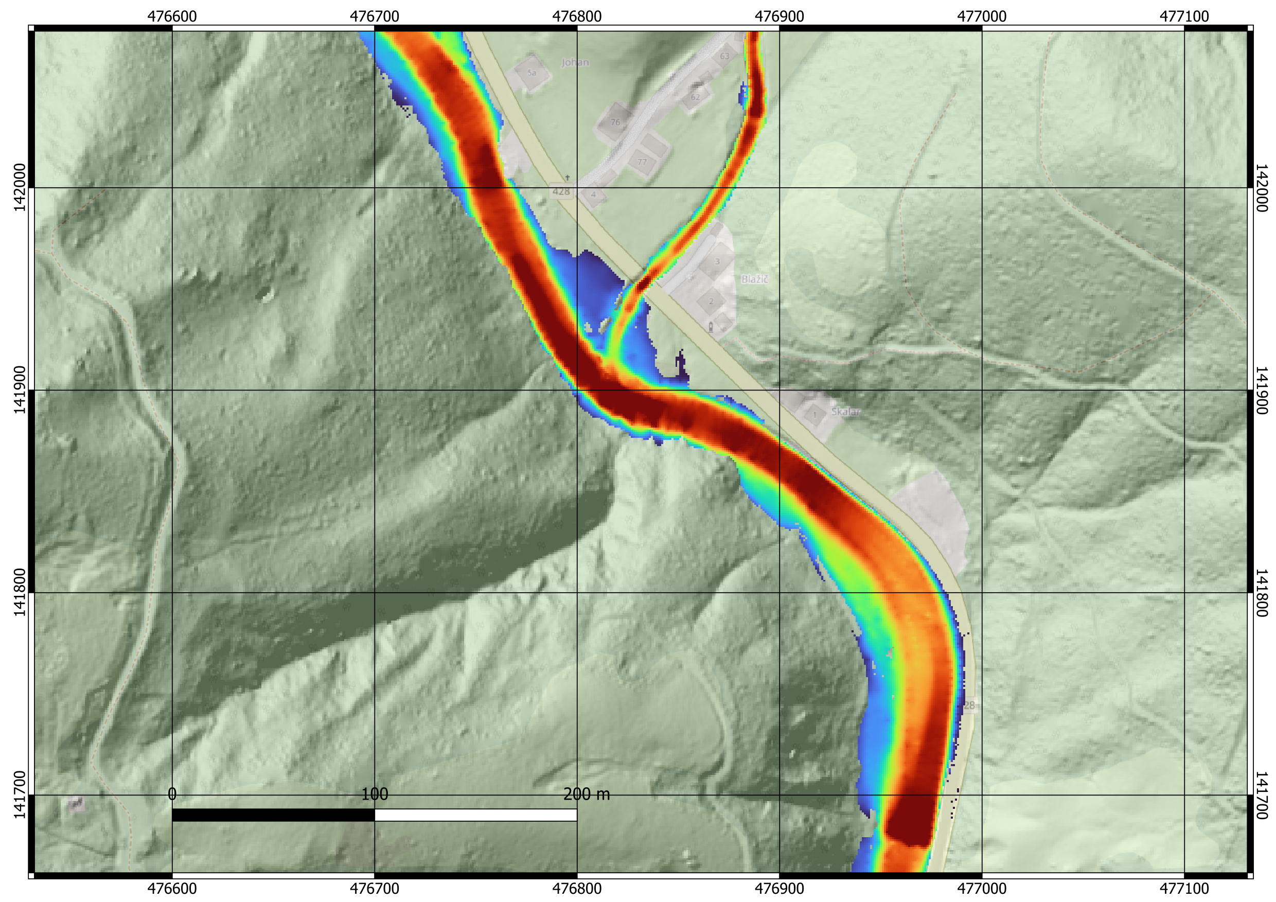
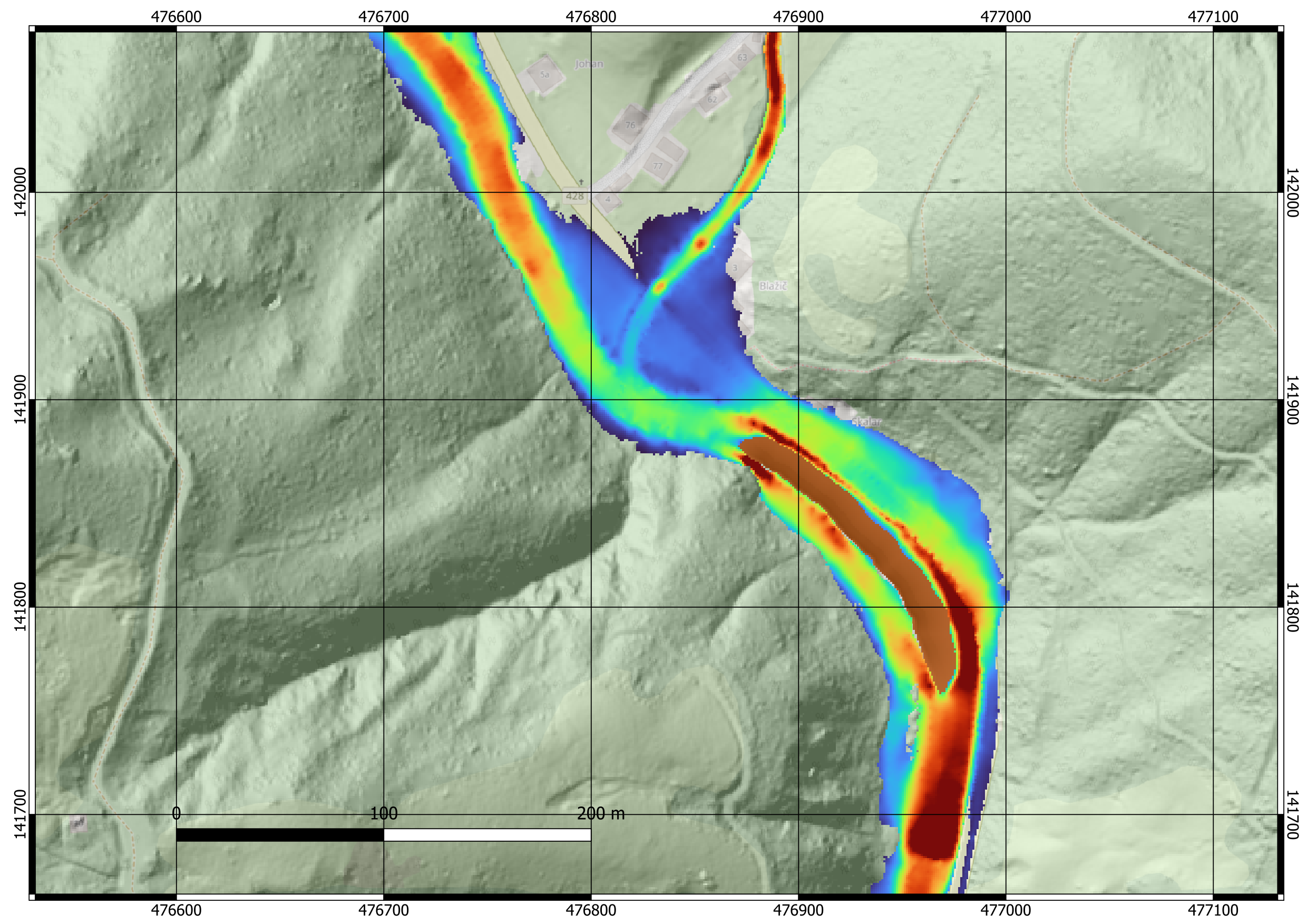
Comparison of velocity of Savinja river and flooding extent in case of unobstructed and landslide obstructed riverbed.
The integrated landslide–flood simulation concept demonstrated a strong capability to efficiently evaluate complex “what-if” scenarios. By coupling terrain modification processes with hydraulic modeling, the approach allows for rapid assessment of how sudden geomorphological changes can influence river flow dynamics and flood behavior. This integrated methodology is particularly valuable in time-sensitive situations, where prompt understanding of potential impacts is essential for informed decision-making.
The approach enables users to systematically investigate potential hazardous hot-spots along river corridors, including areas prone to flow obstruction, backwater effects, or increased floodplain inundation. By simulating multiple scenarios with varying extents of landslide material and hydrological inputs, users can better understand the range of possible outcomes and identify critical thresholds that may trigger adverse conditions.